|
|
Rancho San Francisco (SCV)
Click image to enlarge
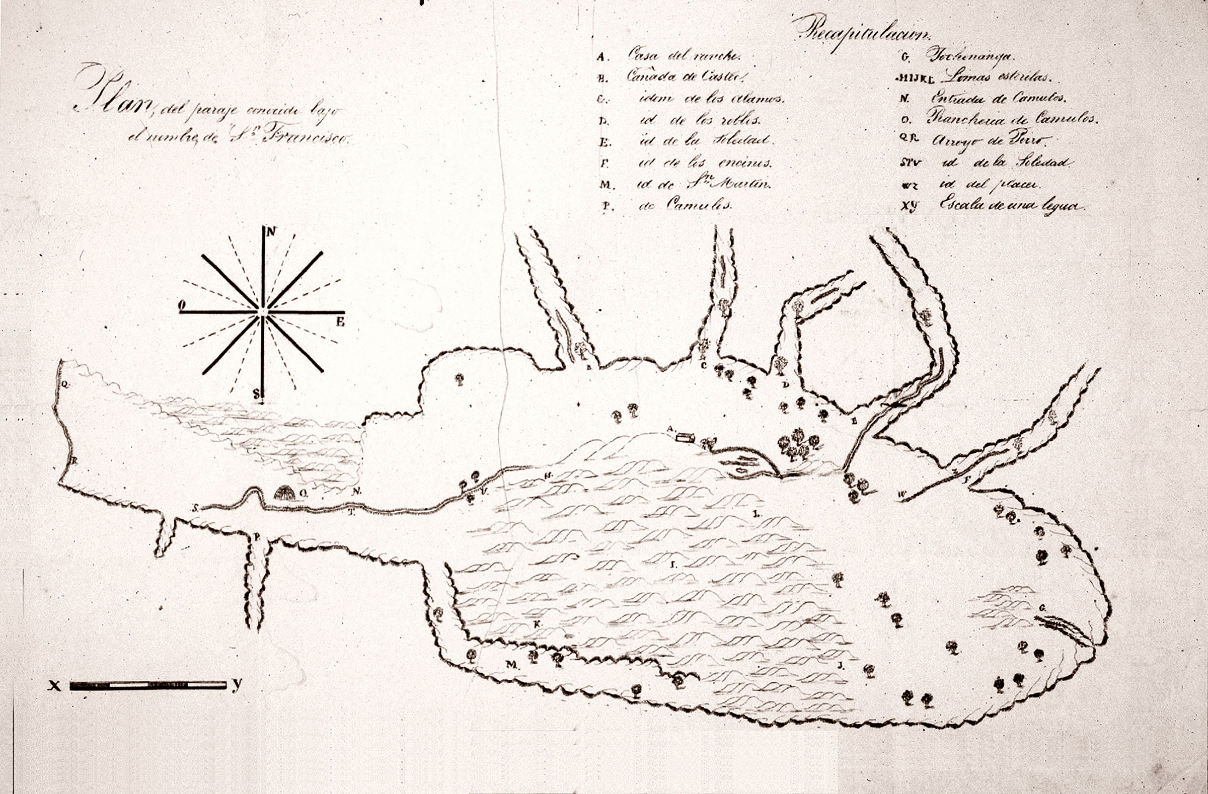
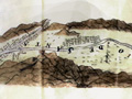
Diseño (plan map) of the Rancho San Francisco, ca. 1843. The map shows the rancho, which comprises most of the Santa Clarita Valley, as it was known to exist when it was owned by the heirs of Antonio del Valle. It had been granted in 1839 to Antonio, who had been using it since 1824 to graze cattle. Landowners during the Spanish and (especially) Mexican period — most land was granted to private owners after the ex-mission lands were secularized in 1833 — were required to file a diseño showing the natural features, major structures and approximate boundaries of the land they owned. This map shows some of the ancient villages once occupied by the Tataviam Indians (most were abandoned by 1803 as the Tataviam were brought to the Mission San Fernando); as well as other local points of interest and the ranch headquarters. Camulos is at left in the "panhandle" area down the Santa Clara River; the old estancia, which the Del Valles used as their ranch home, is at the upper center of the oval area. Offshoots at the top are the various canyons and tributaries — probably (from left to right) Castaic, San Francisquito or Bouquet, Mint, Soledad and Placerita, with the Newhall and/or Elsmere Creek at bottom right. Listed are:
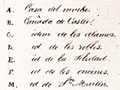
A. Casa del Rancho (Ranch House)
G. Tochananga [a Tataviam Indian village]
JJ2003a: 2400 dpi jpeg from 96 dpi jpeg |
La Puerta: Gateway to Santa Clarita Valley
~1843
Early-mid 1840s
1/3/1870
June 1874
|

The site owner makes no assertions as to ownership of any original copyrights to digitized images. However, these images are intended for Personal or Research use only. Any other kind of use, including but not limited to commercial or scholarly publication in any medium or format, public exhibition, or use online or in a web site, may be subject to additional restrictions including but not limited to the copyrights held by parties other than the site owner. USERS ARE SOLELY RESPONSIBLE for determining the existence of such rights and for obtaining any permissions and/or paying associated fees necessary for the proposed use.
