|
|
Canyon Country, California
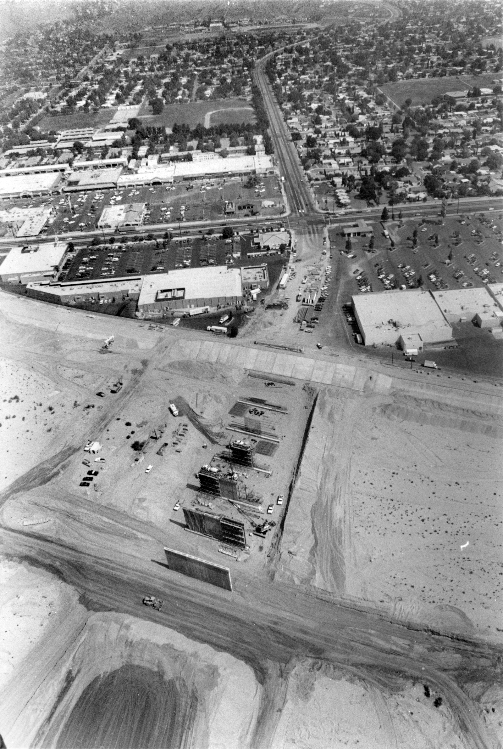
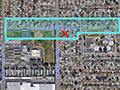
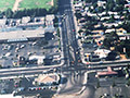
Click image to enlarge Whites Canyon Bridge, shortly after construction began in 1988. Looking north. Santa Clara River in the foreground. The central east-west street is Soledad Canyon Road. The Whites Canyon Bridge is an important component of the Santa Clarita Valley's traffic circulation network, relieving traffic congestion on Soledad Canyon Road by connecting "downtown" Canyon Country to the 14 Freeway by way of Via Princessa. It was one of the last road projects completed by the county of Los Angeles inside the new city of Santa Clarita. Construction started in 1988, shortly after the city incorporated in December 1987. The county had collected funds for construction through bridge and thoroughfare district fees paid by housing and commercial developers. As noted in the Times story below, the funding stream dried up when urban development slowed during the recession years of 1990-92. The bridge was built over the riverbed but it dead-ended in space, prompting locals to call it the "bridge to nowhere." It sat idle until after the 1994 Northridge earthquake when it was finally pushed through to Via Princessa.
'Bridge to Nowhere' Is Finally Opened SANTA CLARITA — Canyon Country's "Bridge to Nowhere" finally goes somewhere. On Tuesday, dozens of city and county officials gathered at a spot overlooking the Santa Clara River to officially open Whites Canyon Bridge — a project that had become a highly visible embarrassment. For most of the last four years, the bridge over the river led from Whites Canyon Road on one side to nothing but an expanse of dirt on the other. The construction project, which started in 1988, came up short of completion funds in 1990. "I got so many calls asking, 'When is that damn thing going to be done?,'" said Jo Anne Darcy, a field deputy for Supervisor Mike Antonovich and a Santa Clarita city councilwoman. "It just became a county joke for so many years." The project soon took on its popular nickname. "There were numerous newspaper articles over the years about the 'Bridge to Nowhere' and the frustration of local residents," said Donna Guyovich, spokeswoman for the county public works department. "That's why we were just as happy as the residents (to see it open), if not more so — to stop taking that teasing." The project had been on Los Angeles County's highway plan since the 1960s and was considered critical as Santa Clarita's population ballooned in the 1980s. Its chief purpose was to provide direct access to Sierra Highway and the Antelope Valley Freeway, allowing traffic to avoid Canyon Country's busiest intersection: Soledad Canyon Road and Sierra Highway. But numerous delays — led by a drop in new construction that dried up tax revenues — stalled construction, making the project an easy target for criticism by people who've seen it as nothing more than a multimillion-dollar dead-end for the past four years. Construction finally resumed in September 1990, and was completed last week. With the opening of the $27.4-million project, politicians wanted to look on the bright side. "This morning, the bridge that was called the 'Bridge to Nowhere' will be called the 'Bridge to Everywhere,'" Antonovich said during the grand opening ceremony. But Tuesday, the joke still had some life left. As Antonovich was chauffeured over the route as its first passenger in a bright red 1958 Corvette provided by the Santa Clarita Valley Corvette Club, one watcher quipped that the car was new when construction began. "At this rate, we're all going to be retired by the time they open another road," said Jack Curenton, leader of a Santa Clarita citizens group that has clamored for city road improvements. Witticisms aside, many residents are simply happy to be able to use the road. "Behind it all and over it all, I hoped they would finish what they started planning 25 years ago," said Jack Ancona, a local transportation activist. "We've been waiting for this for so long; everybody on this side of the valley is going to want to use it." The construction delay had some benefits. When Metrolink suddenly found itself needing to expand its Santa Clarita route after the Northridge earthquake, improvements to the Whites Canyon Road crossing could be made without having to work around a busy road. And Mayor George Pederson, although reluctant to criticize the project, expressed the hope that the city had learned an important lesson for future construction projects. "We need to have the money, when we start them, to be able to finish them."
GT8801: 19200 dpi jpeg from original 8x10 glossy on Kodak paper. |
About Earl Schmidt
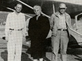
Built Airplane 1928
6-S Ranch Airpark, Shell Progress 1947
6-S Ranch Airpark ~1950s
6-S Ranch Airpark in "China Doll" (1958)
6-S Ranch Airpark in "The Beast of Yucca Flats" (1961)
Location of 6-S Ranch Airpark
Helm Schmidt Home in Newhall 1961
Looking South 1968
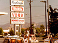
Newberry's, Alpha Beta ~1970s
Aerial: Whites 1979
Whites Canyon Bridge Construction 1988
|
The site owner makes no assertions as to ownership of any original copyrights to digitized images. However, these images are intended for Personal or Research use only. Any other kind of use, including but not limited to commercial or scholarly publication in any medium or format, public exhibition, or use online or in a web site, may be subject to additional restrictions including but not limited to the copyrights held by parties other than the site owner. USERS ARE SOLELY RESPONSIBLE for determining the existence of such rights and for obtaining any permissions and/or paying associated fees necessary for the proposed use.
