
Interpretive Signage Placed at Live Oak Manor Rock Arch
Needham Ranch | Newhall, California
|
A descriptive bronze-finish plaque on a corten-steel pedestal was placed the week of May 18, 2020, next to the Live Oak Manor Rock Arch on the west side of Sierra Highway, just south of the parking lot at the entrance to The Center at Needham Ranch. The sign features a photograph of the arch in its prior location and reads:
LIVE OAK MANOR ROCK ARCH
The arch was originally constructed in 1926 to attract visitors to John Evans Olmstead's Live Oak Manor Cacti Gardens, a point of interest frequented by tourists and sightseers along the "old" San Fernando Road, today's Sierra Highway. The stones in this arch were specially selected by Mr. Olmstead. It took him several years to make the collection. The arch was relocated by Olmstead in 1930, due to the straightening of Sierra Highway from this point south to the Newhall Auto Tunnel, bypassing a curve to the southeast. In 1939, Olmstead closed his gardens. He died in 1945. A local icon, the arch made its second move on August 30, 2018, and was set down July 12, 2019, in its new location, only about 75 yards from the place Olmstead put it in 1930. The arch had to be moved because it stood in the public right-of-way and posed a danger to itself and to motorists entering and exiting the new business park. The developer, Trammell Crow LLC, worked with the city of Santa Clarita and the SCV Historical Society on a successful plan to move the arch in one piece. The new sign was designed, fabricated and installed by JB3D, a design firm in the city of Orange. The 1/4-inch thick plaque is etched, bronzed, and clear-coated. The pedestal is 1/2-inch-thick corten steel, which is a type of weathering steel with a protective oxide film that resists further corrosion. The sign measures 18x24 inches; the overall dimensions are 22x58 inches. The text was developed by Trammell Crow LLC with input from local historians Stan Walker and Leon Worden. The arch and plaque are enclosed within a lodgepole fence. The arch can be seen by passing motorists, and the sign can be viewed from a city trail that runs directly in front of it. First photo (above) courtesy of Trammell Crow LLC; the others by Stan Walker, May 21, 2020. 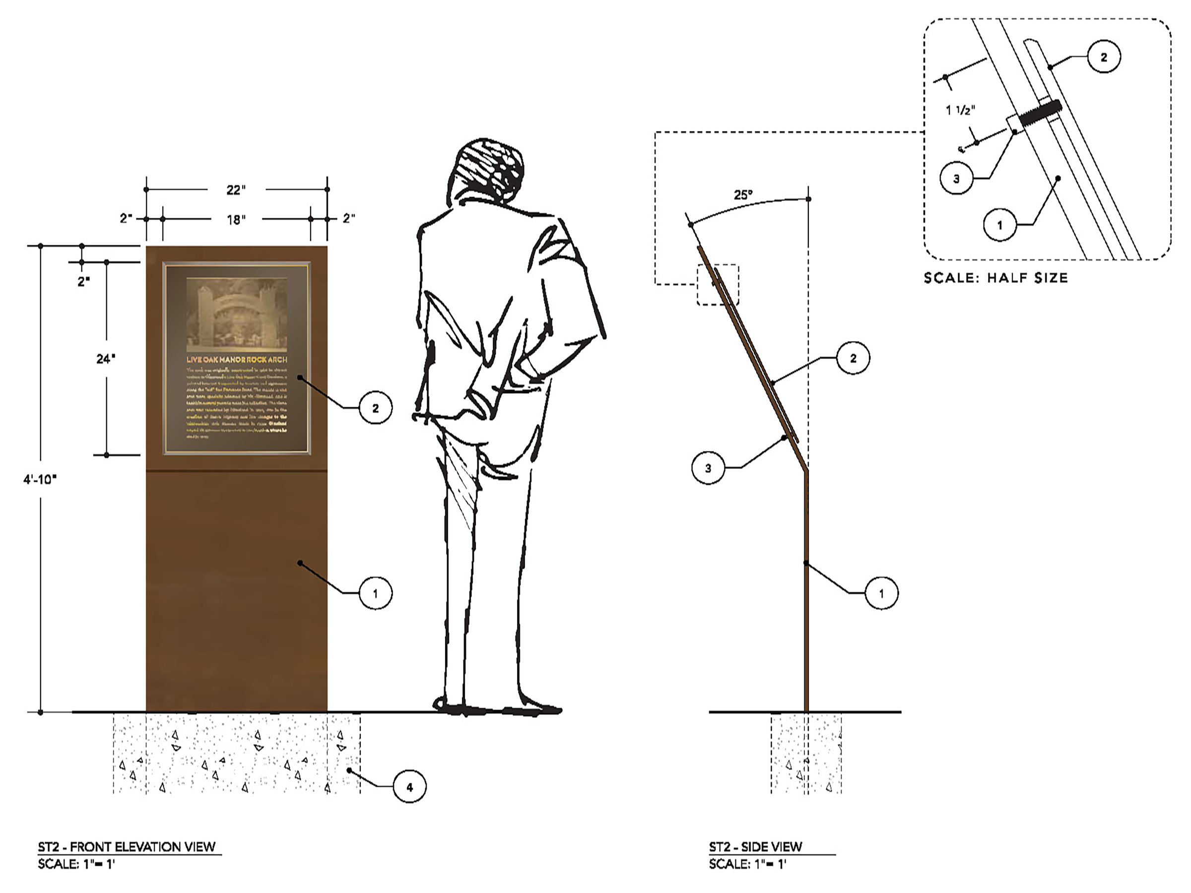
Click to enlarge.
Download original images and documentation here.
|
