|
|
|
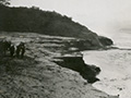
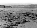
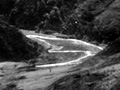
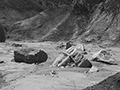
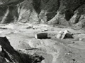
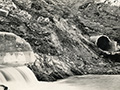
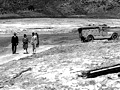
Photographs of San Francisquito Canyon after the St. Francis Dam collapsed just before midnight on March 12, 1928, by Robert Wenzel (NFI). Considering the volume of water that continues to flow out of the dam and penstocks behind the now-missing Power House No. 2, some of these photographs must have been made shortly after sunrise on March 13. Numbers written on the back of the photos indicate there were a minimum of thirteen 5¼x3-inch Velox prints in this series originally. When we acquired them in 2019, there were nine, plus three different 5x7 copy prints that may have come from the same source. Handwritten descriptions by the photographer follow: LW3835a - "Looking up side of the center piece." LW3835b - "San Francis Dam wash." LW3835c - "View showing wash." LW3835d - "Remains of dam and wash / Lake side of dam." LW3835e - "Broken penstock feed lines immediately after disaster." LW3835f - "Center piece, wash side." LW3835g - "Remains of Power House No. 2 showing penstocks." LW3835h - [Reconstruction] "View showing generator piers." LW3835i - [Reconstruction] "Starting of reconstruction." LW3835j - [Copy print: Flood plain immediately below the former dam site.] LW3835j - [Copy print: The tombstone — center section of the dam that remained standing.] LW3835j - [Copy print: Inside reservoir, looking downstream.]
Construction on the 600-foot-long, 185-foot-high St. Francis Dam started in August 1924. With a 12.5-billion-gallon capacity, the reservoir began to fill with water on March 1, 1926. It was completed two months later. At 11:57:30 p.m. on March 12, 1928, the dam failed, sending a 180-foot-high wall of water crashing down San Francisquito Canyon. An estimated 411 people lay dead by the time the floodwaters reached the Pacific Ocean south of Ventura 5½ hours later. It was the second-worst disaster in California history, after the great San Francisco earthquake and fire of 1906, in terms of lives lost — and America's worst civil engineering failure of the 20th Century.
LW3538: Download larger and archival scans here. Prints purchased 2019 by Leon Worden from Ray Smyth of Atwater, Calif., who also donated some of them.
|
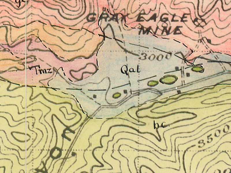
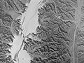
Geology (Nickell 1928)
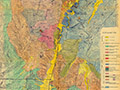
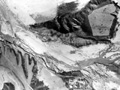
Geology (Elizondo 1953)
Still Flowing 3/13/1928
San Francisquito Cyn.
Just Below Dam
San Francisquito Cyn.
Photo Gallery
Ruiz Cemetery Area
Lower S.F. Canyon
Castaic Junction x3
3 mi. West of Castaic Junction
|

The site owner makes no assertions as to ownership of any original copyrights to digitized images. However, these images are intended for Personal or Research use only. Any other kind of use, including but not limited to commercial or scholarly publication in any medium or format, public exhibition, or use online or in a web site, may be subject to additional restrictions including but not limited to the copyrights held by parties other than the site owner. USERS ARE SOLELY RESPONSIBLE for determining the existence of such rights and for obtaining any permissions and/or paying associated fees necessary for the proposed use.
