|
|
Click image to enlarge
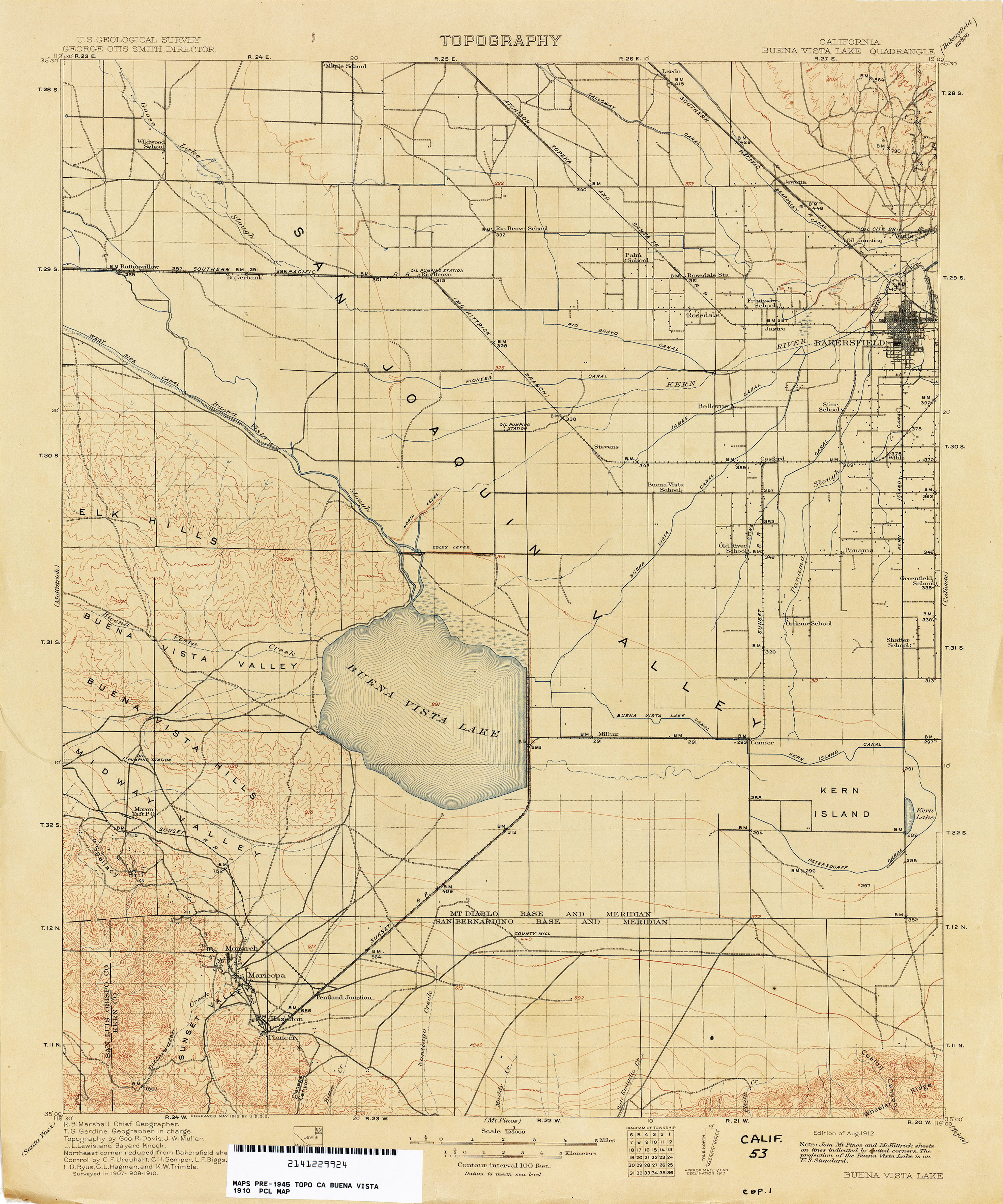
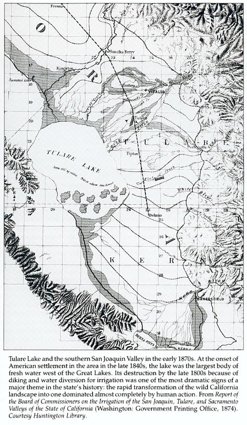
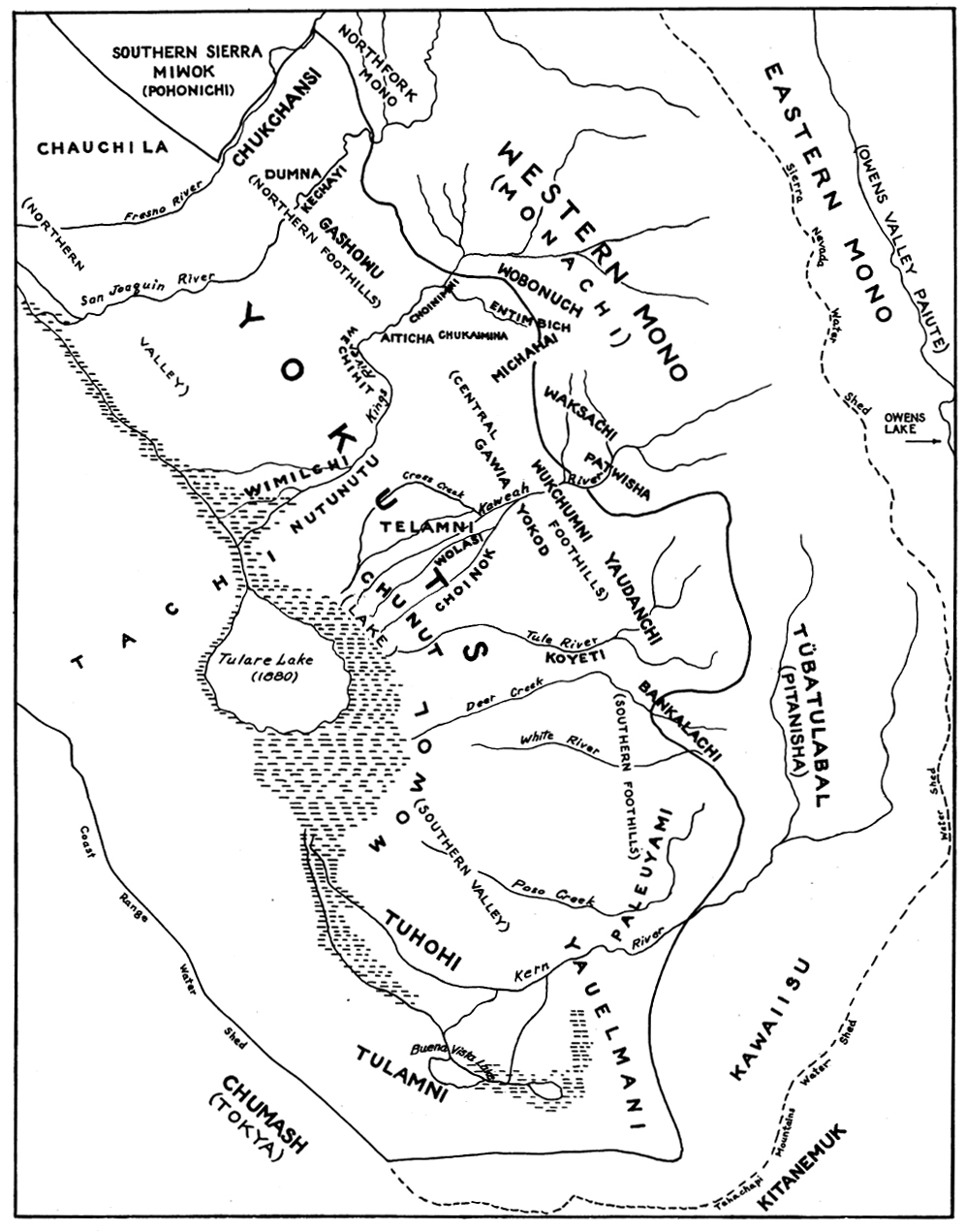
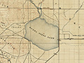
U.S. Geological Survey map: Buena Vista Lake Quadrangle, surveyed 1907-1910, published August 1912. Now dry except for a small aquatic recreation area, Buena Vista Lake was a shallow freshwater lake in the southern San Joaquin Valley with a surface area that extended up to 150 square miles in wet years. It was fed by the Kern River. Dwarfed by Tulare Lake, it was nontheless the second largest of several lakes in the region. Tulare Lake (out of frame to the north of this USGS map) was the largest freshwater lake west of the Mississippi River before it was drained by American farmers in the late 1800s and early 1900s. Buena Vista Lake experienced a similar fate. Named by Pedro Fages, the Buena Vista Lake region was part of the ancestral range of the Southern Valley Yokuts. At the bottom of the USGS map, just right of center, is San Emigdio Creek. This area was home to a number of Barbareno Chumash who fled to this location from the Santa Barbara Mission during the Chumash Revolt of 1824. Today a painted cave and other cultural markers serve as reminders of their presence there. The San Sebastian Indian Reservation of 1852-1864, aka Tejon Indian Reservation, established by Gen. Edward F. Beale, is at far bottom right and extends out of frame to the right (east). Fort Tejon and Grapevine Canyon are out of frame diagonally to the bottom right. Following a line directly south of the bottom-center of the USGS map, one would come to the community of Pine Mountain Club in the Mt. Pinos Quadrangle. The San Bernardino and Mt. Diablo meridians are two of the three principal meridians in California. A baseline is the east-west "parallel" from which all rectangular surveys within the meridian stem.
LW2855: 9600 dpi jpeg.
|
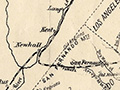
L.A. County 1887
Buena Vista Lake Quad 1912
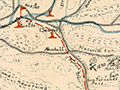
Kirkman Pictorial 1860 L.A. County Map (1937)
|
The site owner makes no assertions as to ownership of any original copyrights to digitized images. However, these images are intended for Personal or Research use only. Any other kind of use, including but not limited to commercial or scholarly publication in any medium or format, public exhibition, or use online or in a web site, may be subject to additional restrictions including but not limited to the copyrights held by parties other than the site owner. USERS ARE SOLELY RESPONSIBLE for determining the existence of such rights and for obtaining any permissions and/or paying associated fees necessary for the proposed use.
