|
|
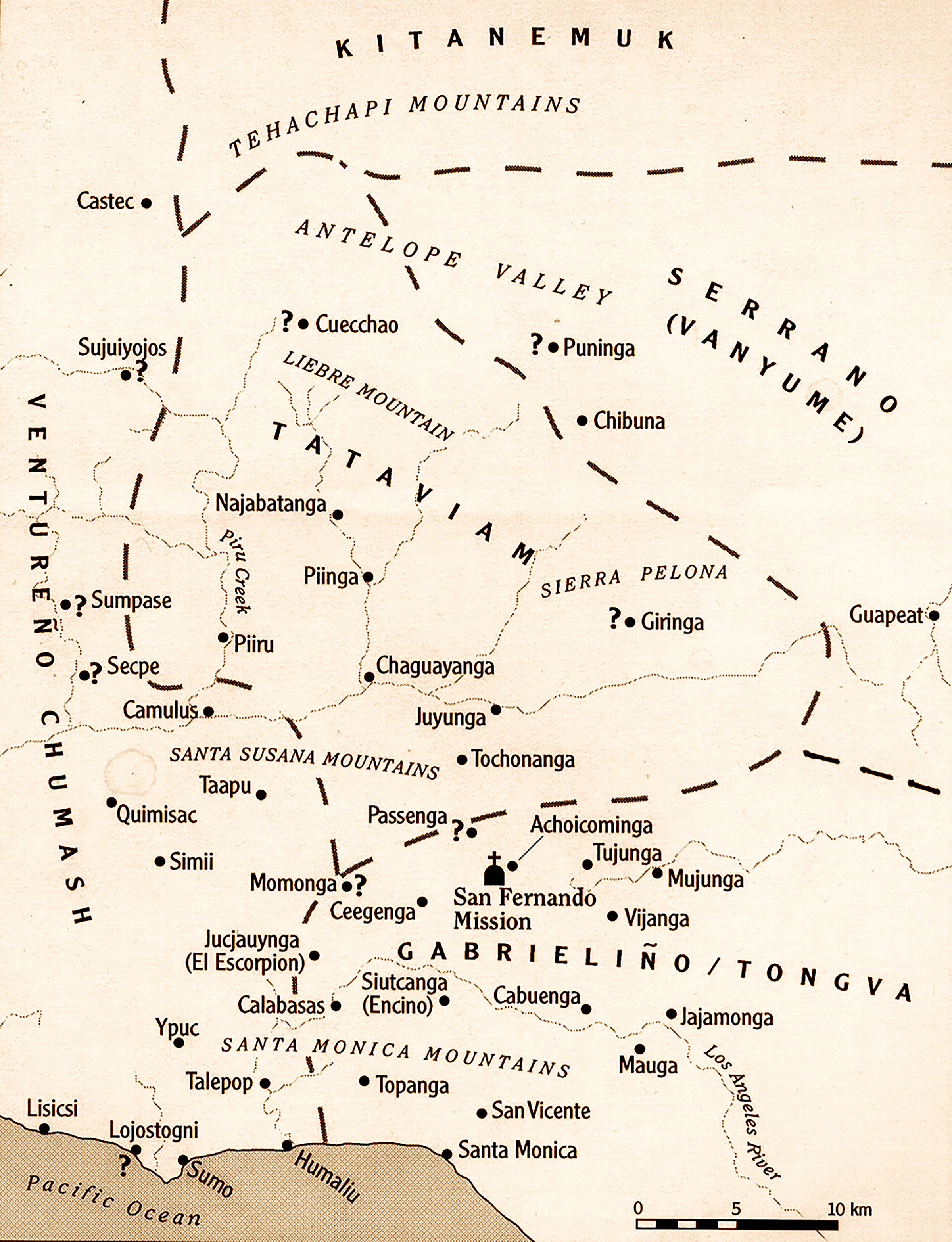
Indian Village Map
Santa Clarita & Environs
Click image to enlarge
Approximation of Indian villages in the Santa Clarita Valley and vicinity. Tataviam villages in the SCV shown here include Tochonanga (in Newhall), Chaguayanga (at Castaic Junction), Piiru (Piru), Camulus (Camulos), Piinga (Elderberry Canyon, under the Castaic Lake Reservoir), and a couple of others whose identity is cloudy.Tataviam Indians, a small group of speakers of a Takik dialect (Uto-Aztecan language family) were present in the Santa Clarita Valley by AD 500, around the time of the introduction of the bow and arrow.
JJ2004: 2400 dpi jpeg from 96 dpi jpeg
to return to the History In Pictures Index
[ RETURN TO TOP ]
[ RETURN TO MAIN INDEX ]
[ PHOTO CREDITS ]
[ BIBLIOGRAPHY ]
[ BOOKS FOR SALE ]
SCVHistory.com is another service of SCVTV, a 501c3 Nonprofit • Site contents ©SCVTV
The site owner makes no assertions as to ownership of any original copyrights to digitized images. However, these images are intended for Personal or Research use only. Any other kind of use, including but not limited to commercial or scholarly publication in any medium or format, public exhibition, or use online or in a web site, may be subject to additional restrictions including but not limited to the copyrights held by parties other than the site owner. USERS ARE SOLELY RESPONSIBLE for determining the existence of such rights and for obtaining any permissions and/or paying associated fees necessary for the proposed use.
The site owner makes no assertions as to ownership of any original copyrights to digitized images. However, these images are intended for Personal or Research use only. Any other kind of use, including but not limited to commercial or scholarly publication in any medium or format, public exhibition, or use online or in a web site, may be subject to additional restrictions including but not limited to the copyrights held by parties other than the site owner. USERS ARE SOLELY RESPONSIBLE for determining the existence of such rights and for obtaining any permissions and/or paying associated fees necessary for the proposed use.
